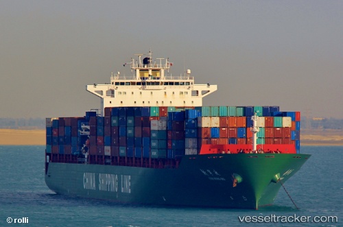
Xin Ning Bo
Current StatusWhere is the vessel?
Xin Ning Bo is currently in 156 nm SE of Honghai, based on AIS data received about 14h ago.
Latest AIS update:
Current position: 18.48809° N, 113.47422° E (156 nm SE of Honghai)
Average speed (last 7 days): Loading…
Average speed (last 30 days): Loading…
Vessel profile: Xin Ning Bo is a Container Ship with dimensions 40m x 280m.
This page combines live AIS, route history, probable destination signals, nearby traffic, and port activity for practical vessel monitoring.
The current position of vessel Xin Ning Bo is 18.48809 lat / 113.47422 lng. Updated: 2026-05-22 02:22:16 UTCNearest reference points:
- 123 nm S of Shadi
- 78 nm SW of Xijiang
- 60 nm SE of Shadi
Details:
Live Vessel Xin Ning Bo Analytics (details, animations, etc.)
Recent AIS points (UTC):
2026-05-21 21:40:49 UTC · 17.36273, 113.38319 · SOG 12.9 kn · COG 3°2026-05-21 23:09:37 UTC · 17.68390, 113.41231 · SOG 13.3 kn · COG 2°
2026-05-21 23:49:02 UTC · 17.83167, 113.42500 · SOG 13 kn · COG -1°
2026-05-22 02:22:16 UTC · 18.48809, 113.47422 · SOG 13 kn · COG 4°