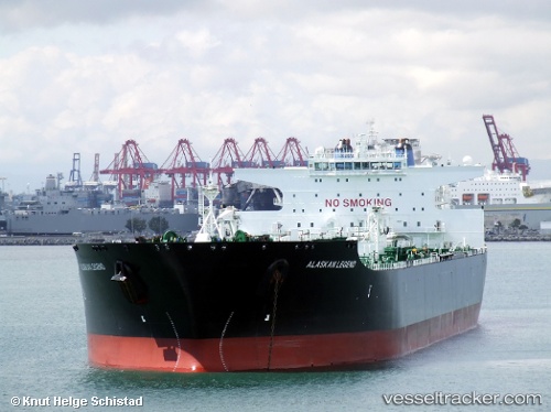
Alaskan Legend
Current StatusWhere is the vessel?
Alaskan Legend is currently in 74 nm SW of Coal Harbour, based on AIS data received about 16h ago.
Latest AIS update:
Current position: 50.10755° N, 129.36604° W (74 nm SW of Coal Harbour)
Average speed (last 7 days): Loading…
Average speed (last 30 days): Loading…
Vessel profile: Alaskan Legend is a Crude Oil Tanker with dimensions 51m x 287m.
This page combines live AIS, route history, probable destination signals, nearby traffic, and port activity for practical vessel monitoring.
The current position of vessel Alaskan Legend is 50.10755 lat / -129.36604 lng. Updated: 2026-05-20 18:12:38 UTCNearest reference points:
- 29 nm NW of Coal Harbour
- Near PORT HARDY
- 63 nm N of PORT HARDY
Details:
Live Vessel Alaskan Legend Analytics (details, animations, etc.)
Recent AIS points (UTC):
2026-05-20 14:18:41 UTC · 49.69190, -128.32066 · SOG 13.5 kn · COG 306°2026-05-20 15:42:50 UTC · 49.84756, -128.71217 · SOG 11.9 kn · COG 305°
2026-05-20 16:19:11 UTC · 49.90972, -128.86729 · SOG 11.6 kn · COG 304°
2026-05-20 18:12:38 UTC · 50.10755, -129.36604 · SOG 12.4 kn · COG 302°