 W NORTH
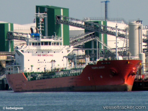
Current Status
Where is the vessel?
W NORTH is currently in Near Gdynia, based on AIS data received about 14h ago.
Latest AIS update:
Current position: 54.51776° N, 18.68041° E (Near Gdynia)
Average speed (last 7 days): Loading…
Average speed (last 30 days): Loading…
Vessel profile: W NORTH is a Oil/Chemical Tanker with dimensions m x m.
This page combines live AIS, route history, probable destination signals, nearby traffic, and port activity for practical vessel monitoring.
The current position of vessel W NORTH is 54.51776 lat / 18.68041 lng. Updated: 2026-05-21 04:00:35 UTCNearest reference points:
- Near Sopot
- Near Gdynia
- Near Nowy Port/Gdansk
Currently sailing under the flag of Malta ![]()
Details:
Live Vessel W NORTH Analytics (details, animations, etc.)
Recent AIS points (UTC):
2026-05-20 23:24:36 UTC · 54.51715, 18.68164 · SOG 0 kn · COG 9°2026-05-21 01:24:36 UTC · 54.51732, 18.68095 · SOG 0 kn · COG 40°
2026-05-21 01:45:34 UTC · 54.51737, 18.68070 · SOG 0 kn · COG 49°
2026-05-21 04:00:35 UTC · 54.51776, 18.68041 · SOG 0 kn · COG 80°