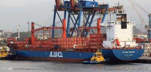
Cap Carmel
Current StatusWhere is the vessel?
Cap Carmel is currently in Near Puerto Cabello, based on AIS data received about 16h ago.
Latest AIS update:
Current position: 10.47071° N, 68.00106° W (Near Puerto Cabello)
Average speed (last 7 days): Loading…
Average speed (last 30 days): Loading…
Vessel profile: Cap Carmel is a Container Ship with dimensions 30m x 208m.
This page combines live AIS, route history, probable destination signals, nearby traffic, and port activity for practical vessel monitoring.
The current position of vessel Cap Carmel is 10.47071 lat / -68.00106 lng. Updated: 2026-05-20 01:39:48 UTCNearest reference points:
- Near Bullenbaai
- Near Las Piedras
- 24 nm NW of Palm Beach
Details:
Live Vessel Cap Carmel Analytics (details, animations, etc.)
Recent AIS points (UTC):
2026-05-19 22:36:08 UTC · 10.52595, -68.02245 · SOG 4.4 kn · COG 179°2026-05-19 23:26:27 UTC · 10.47838, -67.99570 · SOG 2.7 kn · COG 139°
2026-05-20 01:36:48 UTC · 10.47070, -68.00108 · SOG 0 kn · COG 248°
2026-05-20 01:39:48 UTC · 10.47071, -68.00106 · SOG 0 kn · COG 248°