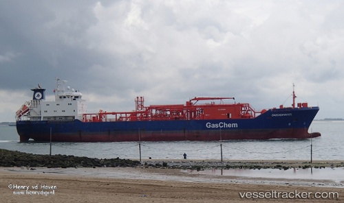
 GAS ROSEA
Current Status
Where is the vessel?
GAS ROSEA is currently in 347 nm N of Tinaquillo, based on AIS data received about 14h ago.
Latest AIS update:
Current position: 15.53139° N, 66.89542° E (347 nm N of Tinaquillo)
Average speed (last 7 days): Loading…
Average speed (last 30 days): Loading…
Vessel profile: GAS ROSEA is a Tanker with dimensions m x m.
This page combines live AIS, route history, probable destination signals, nearby traffic, and port activity for practical vessel monitoring.
The current position of vessel GAS ROSEA is 15.53139 lat / 66.89542 lng. Updated: 2026-05-19 23:39:11 UTCNearest reference points:
- 306 nm SW of Veraval
- Open sea, approx. 401 nm off the nearest listed port
- Open sea, approx. 400 nm off the nearest listed port
Currently sailing under the flag of Indonesia ![]()
Details:
Live Vessel GAS ROSEA Analytics (details, animations, etc.)
Recent AIS points (UTC):
2026-05-19 23:31:03 UTC · 15.50871, 66.91489 · SOG 13.1 kn · COG 316°2026-05-19 23:39:11 UTC · 15.53139, 66.89542 · SOG 13 kn · COG 318°
2026-05-19 23:39:11 UTC · 15.53139, 66.89542 · SOG 13 kn · COG 318°
2026-05-19 23:39:11 UTC · 15.53139, 66.89542 · SOG 13 kn · COG 318°