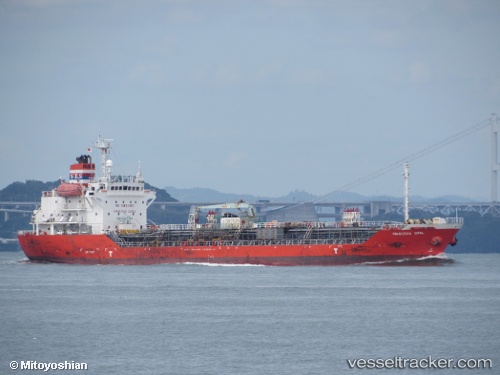
 ALTAY
ALTAY
Current Status
Where is the vessel?
ALTAY is currently in 72 nm NW of Bnei Darom, based on AIS data received about 14h ago.
Latest AIS update:
Current position: 32.69219° N, 30.72765° E (72 nm NW of Bnei Darom)
Average speed (last 7 days): Loading…
Average speed (last 30 days): Loading…
Vessel profile: ALTAY is a Oil/Chemical Tanker with dimensions m x m.
This page combines live AIS, route history, probable destination signals, nearby traffic, and port activity for practical vessel monitoring.
The current position of vessel ALTAY is 32.69219 lat / 30.72765 lng. Updated: 2026-05-20 11:19:41 UTCNearest reference points:
- 68 nm SW of Paphos
- Near Damietta
- Near Alexandria
Currently sailing under the flag of Malta ![]()
Details:
Live Vessel ALTAY Analytics (details, animations, etc.)
Recent AIS points (UTC):
2026-05-20 07:12:13 UTC · 33.39634, 29.99894 · SOG 14.4 kn · COG 142°2026-05-20 10:10:44 UTC · 32.88224, 30.52772 · SOG 13.2 kn · COG 138°
2026-05-20 10:10:44 UTC · 32.88224, 30.52772 · SOG 13.2 kn · COG 138°
2026-05-20 11:19:41 UTC · 32.69219, 30.72765 · SOG 13.4 kn · COG 143°