 AK KARAM
Current Status
Where is the vessel?
AK KARAM is currently in 56 nm E of Polychnitos Lesvou, based on AIS data received about 14h ago.
Latest AIS update:
Current position: 34.41305° N, 27.23803° E (56 nm E of Polychnitos Lesvou)
Average speed (last 7 days): Loading…
Average speed (last 30 days): Loading…
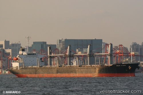
Vessel profile: AK KARAM is a Bulk Carrier with dimensions m x m.
This page combines live AIS, route history, probable destination signals, nearby traffic, and port activity for practical vessel monitoring.
The current position of vessel AK KARAM is 34.41305 lat / 27.23803 lng. Updated: 2026-07-16 11:02:09 UTCNearest reference points:
- 91 nm SE of Polychnitos Lesvou
- 20 nm S of Astypálaia
- 129 nm NW of ABU QIR
Currently sailing under the flag of Barbados ![]()
Details:
Live Vessel AK KARAM Analytics (details, animations, etc.)
Recent AIS points (UTC):
2026-07-16 07:57:19 UTC · 34.51135, 26.57637 · SOG 11.2 kn · COG 93°2026-07-16 08:16:18 UTC · 34.50753, 26.64798 · SOG 11.2 kn · COG 94°
2026-07-16 10:07:19 UTC · 34.48192, 27.06406 · SOG 11.6 kn · COG 95°
2026-07-16 11:02:09 UTC · 34.41305, 27.23803 · SOG 7.7 kn · COG 91°