 NEW FUSION
Current Status
Where is the vessel?
NEW FUSION is currently in 50 nm SE of JASK, based on AIS data received about 19h ago.
Latest AIS update:
Current position: 24.89238° N, 58.14003° E (50 nm SE of JASK)
Average speed (last 7 days): Loading…
Average speed (last 30 days): Loading…
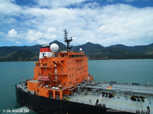
Vessel profile: NEW FUSION is a Oil Products Tanker with dimensions 229m x 32m.
This page combines live AIS, route history, probable destination signals, nearby traffic, and port activity for practical vessel monitoring.
The current position of vessel NEW FUSION is 24.89238 lat / 58.14003 lng. Updated: 2026-05-20 17:13:35 UTCNearest reference points:
- 58 nm S of JASK
- 17 nm SE of JASK
- 42 nm SE of Offshore Fujairah
Currently sailing under the flag of Panama ![]()
Details:
Live Vessel NEW FUSION Analytics (details, animations, etc.)
Recent AIS points (UTC):
2026-05-20 17:13:35 UTC · 24.89238, 58.14003 · SOG 0.1 kn · COG 277°2026-05-20 17:13:35 UTC · 24.89238, 58.14003 · SOG 0.1 kn · COG 277°
2026-05-20 17:13:35 UTC · 24.89238, 58.14003 · SOG 0.1 kn · COG 277°
2026-05-20 17:13:35 UTC · 24.89238, 58.14003 · SOG 0.1 kn · COG 277°