 vesseltracker.com
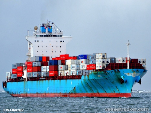
 Anl Tongala
Current Status
Where is the vessel?
Anl Tongala is currently in 60 nm W of Monrovia, based on AIS data received less than 1h ago.
Latest AIS update:
Current position: 6.19549° N, 11.80929° W (60 nm W of Monrovia)
Average speed (last 7 days): Loading…
Average speed (last 30 days): Loading…
Vessel profile: Anl Tongala is a Container Ship with dimensions 259m x 32m.
This page combines live AIS, route history, probable destination signals, nearby traffic, and port activity for practical vessel monitoring.
The current position of vessel Anl Tongala is 6.19549 lat / -11.80929 lng. Updated: 2026-05-15 21:22:46 UTCNearest reference points:
- 15 nm SW of Buchanan
- 126 nm SW of YORK
- 110 nm SW of River Cess
Currently sailing under the flag of Liberia ![]()
Anl Tongala built in 2004 year
Deadweight:
50828 tDetails:
Live Vessel Anl Tongala Analytics (details, animations, etc.)
Recent AIS points (UTC):
2026-05-15 17:33:21 UTC · 5.62826, -10.84863 · SOG 17.7 kn · COG 297°2026-05-15 19:25:38 UTC · 5.90024, -11.31433 · SOG 17.4 kn · COG 299°
2026-05-15 19:54:43 UTC · 5.97167, -11.43667 · SOG 17 kn · COG -1°
2026-05-15 21:22:46 UTC · 6.19549, -11.80929 · SOG 17.7 kn · COG 298°