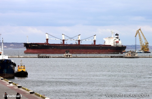
Tong De 98
Current StatusWhere is the vessel?
Tong De 98 is currently in Near Kirikiri, based on AIS data received about 14h ago.
Latest AIS update:
Current position: 6.42743° N, 3.34286° E (Near Kirikiri)
Average speed (last 7 days): Loading…
Average speed (last 30 days): Loading…
Vessel profile: Tong De 98 is a Bulk Carrier with dimensions 32m x 190m.
This page combines live AIS, route history, probable destination signals, nearby traffic, and port activity for practical vessel monitoring.
The current position of vessel Tong De 98 is 6.42743 lat / 3.34286 lng. Updated: 2026-06-23 00:04:38 UTCNearest reference points:
- Near Kirikiri
- Near Lagos
- Near Apapa
Details:
Live Vessel Tong De 98 Analytics (details, animations, etc.)
Recent AIS points (UTC):
2026-06-22 19:22:30 UTC · 6.42743, 3.34285 · SOG 0 kn · COG 81°2026-06-22 21:22:33 UTC · 6.42741, 3.34283 · SOG 0 kn · COG 81°
2026-06-22 22:25:35 UTC · 6.42743, 3.34284 · SOG 0 kn · COG 81°
2026-06-23 00:04:38 UTC · 6.42743, 3.34286 · SOG 0 kn · COG 81°