 ROUTE
ROUTE
Current Status
Where is the vessel?
ROUTE is currently in 69 nm N of Rashid, based on AIS data received about 16h ago.
Latest AIS update:
Current position: 32.53708° N, 30.51141° E (69 nm N of Rashid)
Average speed (last 7 days): Loading…
Average speed (last 30 days): Loading…
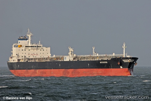
Vessel profile: ROUTE is a Crude Oil Tanker with dimensions 228m x 32m.
This page combines live AIS, route history, probable destination signals, nearby traffic, and port activity for practical vessel monitoring.
The current position of vessel ROUTE is 32.53708 lat / 30.51141 lng. Updated: 2026-05-20 09:41:38 UTCNearest reference points:
- Near Alexandria
- Near EL DEKHEILA
- Near Damietta
Currently sailing under the flag of Barbados ![]()
ROUTE built in 2004 year
Deadweight:
69714 tDetails:
Live Vessel ROUTE Analytics (details, animations, etc.)
Recent AIS points (UTC):
2026-05-20 09:41:38 UTC · 32.53708, 30.51141 · SOG 12.5 kn · COG 106°2026-05-20 09:41:38 UTC · 32.53708, 30.51141 · SOG 12.5 kn · COG 106°
2026-05-20 09:41:38 UTC · 32.53708, 30.51141 · SOG 12.5 kn · COG 106°
2026-05-20 09:41:38 UTC · 32.53708, 30.51141 · SOG 12.5 kn · COG 106°