 vesseltracker.com
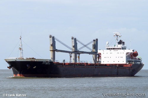
 NIMET TORLAK
Current Status
Where is the vessel?
NIMET TORLAK is currently in Near TUZLA, based on AIS data received about 1h ago.
Latest AIS update:
Current position: 40.82426° N, 29.22610° E (Near TUZLA)
Average speed (last 7 days): Loading…
Average speed (last 30 days): Loading…
Vessel profile: NIMET TORLAK is a Bulk Carrier with dimensions 138m x 25m.
This page combines live AIS, route history, probable destination signals, nearby traffic, and port activity for practical vessel monitoring.
The current position of vessel NIMET TORLAK is 40.82426 lat / 29.22610 lng. Updated: 2026-05-14 00:15:53 UTCNearest reference points:
- Near TUZLA
- Near PENDIK
- Near Tuzla Free Zone
Currently sailing under the flag of Liberia ![]()
NIMET TORLAK built in 2003 year
Deadweight:
18820 tDetails:
Live Vessel NIMET TORLAK Analytics (details, animations, etc.)
Recent AIS points (UTC):
2026-05-13 20:15:52 UTC · 40.82391, 29.22658 · SOG 0.2 kn · COG 32°2026-05-13 21:33:52 UTC · 40.82387, 29.22653 · SOG 0.1 kn · COG 40°
2026-05-13 22:42:52 UTC · 40.82369, 29.22661 · SOG 0.1 kn · COG 39°
2026-05-14 00:15:53 UTC · 40.82426, 29.22610 · SOG 0 kn · COG 61°