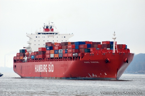
Monte Pascoal
Current StatusWhere is the vessel?
Monte Pascoal is currently in Near Bremerhaven-Speckenbüttel, based on AIS data received about 15h ago.
Latest AIS update:
Current position: 53.59821° N, 8.51529° E (Near Bremerhaven-Speckenbüttel)
Average speed (last 7 days): Loading…
Average speed (last 30 days): Loading…
Vessel profile: Monte Pascoal is a Container Ship with dimensions 40m x 272m.
This page combines live AIS, route history, probable destination signals, nearby traffic, and port activity for practical vessel monitoring.
The current position of vessel Monte Pascoal is 53.59821 lat / 8.51529 lng. Updated: 2026-05-19 04:11:30 UTCNearest reference points:
- Near Bremerhaven
- Near Sandstedt
- Near Brake
Details:
Live Vessel Monte Pascoal Analytics (details, animations, etc.)
Recent AIS points (UTC):
2026-05-19 01:20:26 UTC · 53.59822, 8.51529 · SOG 0 kn · COG 321°2026-05-19 01:47:29 UTC · 53.59821, 8.51529 · SOG 0 kn · COG 321°
2026-05-19 03:59:32 UTC · 53.59821, 8.51529 · SOG 0 kn · COG 321°
2026-05-19 04:11:30 UTC · 53.59821, 8.51529 · SOG 0 kn · COG 321°