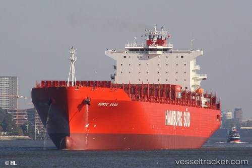
Monte Rosa
Current StatusWhere is the vessel?
Monte Rosa is currently in 68 nm E of Lower Sackville, based on AIS data received about 14h ago.
Latest AIS update:
Current position: 46.65818° N, 40.09534° W (68 nm E of Lower Sackville)
Average speed (last 7 days): Loading…
Average speed (last 30 days): Loading…
Vessel profile: Monte Rosa is a Container Ship with dimensions 40m x 272m.
This page combines live AIS, route history, probable destination signals, nearby traffic, and port activity for practical vessel monitoring.
The current position of vessel Monte Rosa is 46.65818 lat / -40.09534 lng. Updated: 2026-05-19 21:19:18 UTCNearest reference points:
- 137 nm E of Lower Sackville
- 70 nm N of Lower Sackville
Details:
Live Vessel Monte Rosa Analytics (details, animations, etc.)
Recent AIS points (UTC):
2026-05-19 17:49:37 UTC · 47.22465, -39.06061 · SOG 17.2 kn · COG 237°2026-05-19 19:04:44 UTC · 47.01060, -39.46264 · SOG 16 kn · COG 237°
2026-05-19 19:47:13 UTC · 46.89910, -39.67632 · SOG 15.5 kn · COG 231°
2026-05-19 21:19:18 UTC · 46.65818, -40.09534 · SOG 13.7 kn · COG 231°