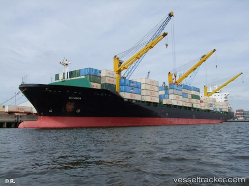
Artam
Current StatusWhere is the vessel?
Artam is currently in Near Chabahar, based on AIS data received about 14h ago.
Latest AIS update:
Current position: 25.21455° N, 60.70969° E (Near Chabahar)
Average speed (last 7 days): Loading…
Average speed (last 30 days): Loading…
Vessel profile: Artam is a Container Ship with dimensions 30m x 220m.
This page combines live AIS, route history, probable destination signals, nearby traffic, and port activity for practical vessel monitoring.
The current position of vessel Artam is 25.21455 lat / 60.70969 lng. Updated: 2026-05-20 10:13:44 UTCNearest reference points:
- 59 nm S of Chah Bahar
- 97 nm S of Chabahar
- 101 nm SE of Chabahar
Details:
Live Vessel Artam Analytics (details, animations, etc.)
Recent AIS points (UTC):
2026-05-20 06:20:21 UTC · 25.21225, 60.70960 · SOG 0.1 kn · COG 292°2026-05-20 07:24:39 UTC · 25.21244, 60.70955 · SOG 0.5 kn · COG 285°
2026-05-20 07:52:41 UTC · 25.21297, 60.70978 · SOG 3.8 kn · COG 273°
2026-05-20 10:13:44 UTC · 25.21455, 60.70969 · SOG 0.8 kn · COG -1°