 vesseltracker.com
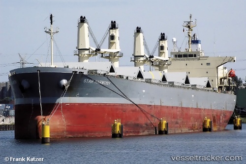
 Star Harmony
Current Status
Where is the vessel?
Star Harmony is currently in Near EL DEKHEILA, based on AIS data received about 10h ago.
Latest AIS update:
Current position: 31.13610° N, 29.79503° E (Near EL DEKHEILA)
Average speed (last 7 days): Loading…
Average speed (last 30 days): Loading…
Vessel profile: Star Harmony is a Bulk Carrier with dimensions 188m x 32m.
This page combines live AIS, route history, probable destination signals, nearby traffic, and port activity for practical vessel monitoring.
The current position of vessel Star Harmony is 31.13610 lat / 29.79503 lng. Updated: 2026-05-15 05:43:28 UTCNearest reference points:
- Near Alexandria
- Near EL DEKHEILA
- 13 nm W of EL DEKHEILA
Currently sailing under the flag of Panama ![]()
Star Harmony built in 2005 year
Deadweight:
52980 tDetails:
Live Vessel Star Harmony Analytics (details, animations, etc.)
Recent AIS points (UTC):
2026-05-15 05:43:28 UTC · 31.13610, 29.79503 · SOG 0 kn · COG 32°2026-05-15 05:43:28 UTC · 31.13610, 29.79503 · SOG 0 kn · COG 32°
2026-05-15 05:43:28 UTC · 31.13610, 29.79503 · SOG 0 kn · COG 32°
2026-05-15 05:43:28 UTC · 31.13610, 29.79503 · SOG 0 kn · COG 32°