 vesseltracker.com
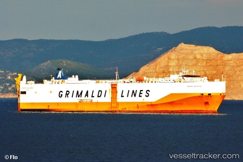
 Grande Anversa
Current Status
Where is the vessel?
Grande Anversa is currently in 20 nm S of Vescovato, based on AIS data received about 1h ago.
Latest AIS update:
Current position: 42.15697° N, 9.34481° W (20 nm S of Vescovato)
Average speed (last 7 days): Loading…
Average speed (last 30 days): Loading…
Vessel profile: Grande Anversa is a Vehicles Carrier with dimensions 176m x 176m.
This page combines live AIS, route history, probable destination signals, nearby traffic, and port activity for practical vessel monitoring.
The current position of vessel Grande Anversa is 42.15697 lat / -9.34481 lng. Updated: 2026-05-14 19:50:10 UTCNearest reference points:
- Near Corujo
- Near Vigo
- Near Portosin
Currently sailing under the flag of Italy ![]()
Grande Anversa built in 2004 year
Deadweight:
12420 tDetails:
Live Vessel Grande Anversa Analytics (details, animations, etc.)
Recent AIS points (UTC):
2026-05-14 16:34:30 UTC · 41.47048, -9.05749 · SOG 13.7 kn · COG 340°2026-05-14 18:09:54 UTC · 41.80756, -9.19479 · SOG 12.9 kn · COG 347°
2026-05-14 19:09:42 UTC · 42.01790, -9.27745 · SOG 13.1 kn · COG 342°
2026-05-14 19:50:10 UTC · 42.15697, -9.34481 · SOG 13.1 kn · COG 342°