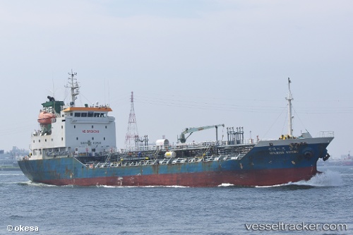
 SUNRISE SAMBU
Current Status
Where is the vessel?
SUNRISE SAMBU is currently in Near Nan-Ching, based on AIS data received about 14h ago.
Latest AIS update:
Current position: 32.21276° N, 118.85671° E (Near Nan-Ching)
Average speed (last 7 days): Loading…
Average speed (last 30 days): Loading…
Vessel profile: SUNRISE SAMBU is a Chemical/Oil Products Tanker with dimensions 92m x 14m.
This page combines live AIS, route history, probable destination signals, nearby traffic, and port activity for practical vessel monitoring.
The current position of vessel SUNRISE SAMBU is 32.21276 lat / 118.85671 lng. Updated: 2026-07-07 09:24:39 UTCNearest reference points:
- Near Nan-Ching
- 10 nm NE of Nan-Ching
- 11 nm NE of Nan-Ching
Currently sailing under the flag of Korea (Republic of) ![]()
SUNRISE SAMBU built in 2004 year
Deadweight:
3613 tDetails:
Live Vessel SUNRISE SAMBU Analytics (details, animations, etc.)
Recent AIS points (UTC):
2026-07-07 06:21:52 UTC · 32.21274, 118.85672 · SOG 0 kn · COG 329°2026-07-07 07:52:17 UTC · 32.21277, 118.85674 · SOG 0 kn · COG 329°
2026-07-07 08:24:21 UTC · 32.21279, 118.85671 · SOG 0 kn · COG 329°
2026-07-07 09:24:39 UTC · 32.21276, 118.85671 · SOG 0 kn · COG 329°