 vesseltracker.com
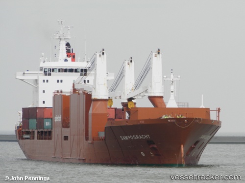
 Sampogracht
Current Status
Where is the vessel?
Sampogracht is currently in Near Husum, based on AIS data received less than 1h ago.
Latest AIS update:
Current position: 63.31869° N, 19.15514° E (Near Husum)
Average speed (last 7 days): Loading…
Average speed (last 30 days): Loading…
Vessel profile: Sampogracht is a Multi Purpose Carrier with dimensions 185m x 25m.
This page combines live AIS, route history, probable destination signals, nearby traffic, and port activity for practical vessel monitoring.
The current position of vessel Sampogracht is 63.31869 lat / 19.15514 lng. Updated: 2026-05-16 12:20:55 UTCNearest reference points:
- 20 nm S of HOLMSUND
- Near Stockviksverken
- Near Iggesund
Currently sailing under the flag of Netherlands ![]()
Sampogracht built in 2005 year
Deadweight:
23688 tDetails:
Live Vessel Sampogracht Analytics (details, animations, etc.)
Recent AIS points (UTC):
2026-05-16 07:44:55 UTC · 63.31870, 19.15510 · SOG 0 kn · COG 356°2026-05-16 09:32:55 UTC · 63.31870, 19.15510 · SOG 0 kn · COG 356°
2026-05-16 10:02:55 UTC · 63.31869, 19.15509 · SOG 0 kn · COG 356°
2026-05-16 12:20:55 UTC · 63.31869, 19.15514 · SOG 0 kn · COG 356°