 vesseltracker.com
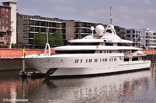
 Queen Miri
Current Status
Where is the vessel?
Queen Miri is currently in Near Genova, based on AIS data received less than 1h ago.
Latest AIS update:
Current position: 44.39334° N, 8.93657° E (Near Genova)
Average speed (last 7 days): Loading…
Average speed (last 30 days): Loading…
Vessel profile: Queen Miri is a Service Ship with dimensions 85m x 85m.
This page combines live AIS, route history, probable destination signals, nearby traffic, and port activity for practical vessel monitoring.
The current position of vessel Queen Miri is 44.39334 lat / 8.93657 lng. Updated: 2026-05-14 17:25:00 UTCNearest reference points:
- Near Genova
- Near Sestri Ponente
- Near Multedo
Currently sailing under the flag of Marshall Is ![]()
Queen Miri built in 2004 year
Deadweight:
600 tDetails:
Live Vessel Queen Miri Analytics (details, animations, etc.)
Recent AIS points (UTC):
2026-05-14 14:06:58 UTC · 44.39332, 8.93657 · SOG 0 kn · COG 293°2026-05-14 16:10:01 UTC · 44.39333, 8.93658 · SOG 0 kn · COG 294°
2026-05-14 16:16:00 UTC · 44.39333, 8.93657 · SOG 0 kn · COG 294°
2026-05-14 17:25:00 UTC · 44.39334, 8.93657 · SOG 0 kn · COG 294°