 8PYO2
8PYO2
Current Status
Where is the vessel?
8PYO2 is currently in 189 nm SW of Lahat, based on AIS data received about 16h ago.
Latest AIS update:
Current position: 5.22478° S, 100.71105° E (189 nm SW of Lahat)
Average speed (last 7 days): Loading…
Average speed (last 30 days): Loading…
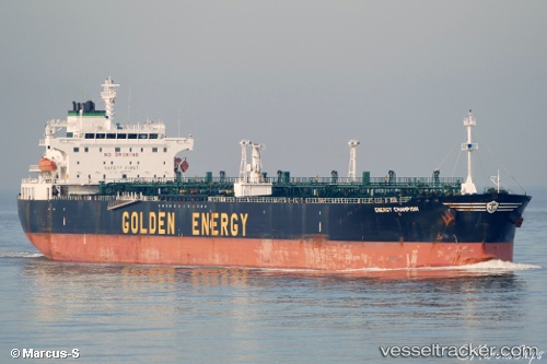
Vessel profile: 8PYO2 is a Crude Oil Tanker with dimensions 228m x 32m.
This page combines live AIS, route history, probable destination signals, nearby traffic, and port activity for practical vessel monitoring.
The current position of vessel 8PYO2 is -5.22478 lat / 100.71105 lng. Updated: 2026-07-06 22:03:52 UTCNearest reference points:
- 293 nm SW of Lahat
- 163 nm W of Panjang
Currently sailing under the flag of Barbados ![]()
8PYO2 built in 2005 year
Deadweight:
70681 tDetails:
Live Vessel 8PYO2 Analytics (details, animations, etc.)
Recent AIS points (UTC):
2026-07-06 18:47:42 UTC · -4.93690, 100.14015 · SOG 12.1 kn · COG 116°2026-07-06 21:17:34 UTC · -5.16183, 100.57515 · SOG 11.5 kn · COG 117°
2026-07-06 22:03:52 UTC · -5.22478, 100.71105 · SOG 11.7 kn · COG 117°
2026-07-06 22:03:52 UTC · -5.22478, 100.71105 · SOG 11.7 kn · COG 117°