 MARISCA TIDE
Current Status
Where is the vessel?
MARISCA TIDE is currently in 45 nm NE of PENGERANG, based on AIS data received about 14h ago.
Latest AIS update:
Current position: 1.77953° N, 104.75800° E (45 nm NE of PENGERANG)
Average speed (last 7 days): Loading…
Average speed (last 30 days): Loading…
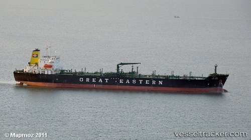
Vessel profile: MARISCA TIDE is a Crude Oil Tanker with dimensions m x m.
This page combines live AIS, route history, probable destination signals, nearby traffic, and port activity for practical vessel monitoring.
The current position of vessel MARISCA TIDE is 1.77953 lat / 104.75800 lng. Updated: 2026-05-21 04:17:09 UTCNearest reference points:
- 45 nm NE of PENGERANG
- 51 nm NE of PENGERANG
- 47 nm NE of PENGERANG
Currently sailing under the flag of Saint Kitts and Nevis ![]()
Details:
Live Vessel MARISCA TIDE Analytics (details, animations, etc.)
Recent AIS points (UTC):
2026-05-21 01:42:00 UTC · 1.78083, 104.75864 · SOG 0.2 kn · COG 161°2026-05-21 02:24:10 UTC · 1.78077, 104.75845 · SOG 0 kn · COG 149°
2026-05-21 02:53:10 UTC · 1.78066, 104.75827 · SOG 0.1 kn · COG 145°
2026-05-21 04:17:09 UTC · 1.77953, 104.75800 · SOG 0.2 kn · COG 119°