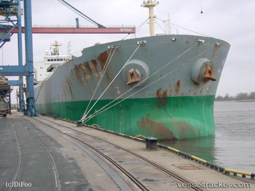
An Ho
Current StatusWhere is the vessel?
An Ho is currently in Near Ust-Luga, based on AIS data received about 23h ago.
Latest AIS update:
Current position: 59.68578° N, 28.42053° E (Near Ust-Luga)
Average speed (last 7 days): Loading…
Average speed (last 30 days): Loading…
Vessel profile: An Ho is a Bulk Carrier with dimensions 32m x 225m.
This page combines live AIS, route history, probable destination signals, nearby traffic, and port activity for practical vessel monitoring.
The current position of vessel An Ho is 59.68578 lat / 28.42053 lng. Updated: 2026-05-20 10:58:03 UTCNearest reference points:
- Near Ust'-Luga
- Near Ust-Luga
- Near Ruch’I
Details:
Live Vessel An Ho Analytics (details, animations, etc.)
Recent AIS points (UTC):
2026-05-20 10:58:03 UTC · 59.68578, 28.42053 · SOG 0.1 kn · COG 181°2026-05-20 10:58:03 UTC · 59.68578, 28.42053 · SOG 0.1 kn · COG 181°
2026-05-20 10:58:03 UTC · 59.68578, 28.42053 · SOG 0.1 kn · COG 181°
2026-05-20 10:58:03 UTC · 59.68578, 28.42053 · SOG 0.1 kn · COG 181°