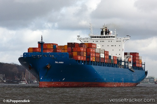
 Talassa
Current Status
Where is the vessel?
Talassa is currently in 20 nm SE of Goudiniweg, based on AIS data received about 14h ago.
Latest AIS update:
Current position: 34.89366° S, 19.48758° E (20 nm SE of Goudiniweg)
Average speed (last 7 days): Loading…
Average speed (last 30 days): Loading…
Vessel profile: Talassa is a Container Ship with dimensions 276m x 276m.
This page combines live AIS, route history, probable destination signals, nearby traffic, and port activity for practical vessel monitoring.
The current position of vessel Talassa is -34.89366 lat / 19.48758 lng. Updated: 2026-05-20 10:28:14 UTCNearest reference points:
- 15 nm SE of Moorreesburg
- Near Mitchells Plain
- 18 nm SW of Cape Of Good Hope
Currently sailing under the flag of Portugal ![]()
Talassa built in 2005 year
Deadweight:
68228 tDetails:
Live Vessel Talassa Analytics (details, animations, etc.)
Recent AIS points (UTC):
2026-05-20 07:36:53 UTC · -34.80197, 20.54969 · SOG 18.7 kn · COG 244°2026-05-20 08:14:26 UTC · -34.88459, 20.33177 · SOG 19 kn · COG 249°
2026-05-20 09:39:33 UTC · -34.94412, 19.80152 · SOG 19.2 kn · COG 280°
2026-05-20 10:28:14 UTC · -34.89366, 19.48758 · SOG 19.3 kn · COG 280°