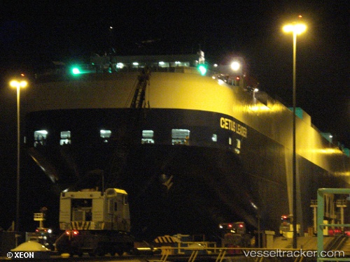
Cetus Leader
Current StatusWhere is the vessel?
Cetus Leader is currently in 20 nm SW of San Gregorio, based on AIS data received about 14h ago.
Latest AIS update:
Current position: 37.10941° N, 122.69711° W (20 nm SW of San Gregorio)
Average speed (last 7 days): Loading…
Average speed (last 30 days): Loading…
Vessel profile: Cetus Leader is a Vehicles Carrier with dimensions 32m x 199m.
This page combines live AIS, route history, probable destination signals, nearby traffic, and port activity for practical vessel monitoring.
The current position of vessel Cetus Leader is 37.10941 lat / -122.69711 lng. Updated: 2026-05-21 06:07:16 UTCNearest reference points:
- Near Oakland
- Near San Francisco
- Near Treasure Island/Los Angeles
Details:
Live Vessel Cetus Leader Analytics (details, animations, etc.)
Recent AIS points (UTC):
2026-05-21 02:41:55 UTC · 37.66947, -122.71818 · SOG 9.7 kn · COG 203°2026-05-21 04:14:25 UTC · 37.41825, -122.72736 · SOG 10.2 kn · COG 183°
2026-05-21 05:12:14 UTC · 37.25664, -122.72748 · SOG 10 kn · COG 185°
2026-05-21 06:07:16 UTC · 37.10941, -122.69711 · SOG 9.4 kn · COG 159°