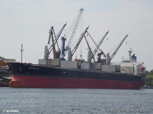
Besiktas m
Current StatusWhere is the vessel?
Besiktas m is currently in Near Djibouti, based on AIS data received about 14h ago.
Latest AIS update:
Current position: 11.65194° N, 43.16577° E (Near Djibouti)
Average speed (last 7 days): Loading…
Average speed (last 30 days): Loading…
Vessel profile: Besiktas m is a Bulk Carrier with dimensions 32m x 189m.
This page combines live AIS, route history, probable destination signals, nearby traffic, and port activity for practical vessel monitoring.
The current position of vessel Besiktas m is 11.65194 lat / 43.16577 lng. Updated: 2026-06-10 16:06:51 UTCNearest reference points:
- Near Djibouti
Details:
Live Vessel Besiktas m Analytics (details, animations, etc.)
Recent AIS points (UTC):
2026-06-10 13:18:52 UTC · 11.65156, 43.16559 · SOG 0 kn · COG 95°2026-06-10 13:51:11 UTC · 11.65161, 43.16560 · SOG 0 kn · COG 97°
2026-06-10 15:52:00 UTC · 11.65194, 43.16577 · SOG 0 kn · COG 107°
2026-06-10 16:06:51 UTC · 11.65194, 43.16577 · SOG 0 kn · COG 106°