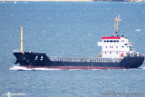
Chang Yu
Current StatusWhere is the vessel?
Chang Yu is currently in 16 nm E of Dalian, based on AIS data received about 15h ago.
Latest AIS update:
Current position: 38.85597° N, 121.97297° E (16 nm E of Dalian)
Average speed (last 7 days): Loading…
Average speed (last 30 days): Loading…
Vessel profile: Chang Yu is a Bulk Carrier with dimensions 13m x 80m.
This page combines live AIS, route history, probable destination signals, nearby traffic, and port activity for practical vessel monitoring.
The current position of vessel Chang Yu is 38.85597 lat / 121.97297 lng. Updated: 2026-05-20 17:07:11 UTCNearest reference points:
- 15 nm E of Dalian
- 15 nm SE of Dalian
- 20 nm E of Dalian
Details:
Live Vessel Chang Yu Analytics (details, animations, etc.)
Recent AIS points (UTC):
2026-05-20 13:22:49 UTC · 38.85613, 121.97307 · SOG 1.5 kn · COG 14°2026-05-20 14:04:46 UTC · 38.85625, 121.97298 · SOG 0 kn · COG 20°
2026-05-20 15:49:46 UTC · 38.85600, 121.97302 · SOG 0.6 kn · COG 4°
2026-05-20 17:07:11 UTC · 38.85597, 121.97297 · SOG 0.5 kn · COG 348°