.
Vessel photo of BERTHA (IMO 9292163) vesseltracker.com

CI flag BERTHA

Vessel type: Crude Oil Tanker | IMO: 9292163 | MMSI: MMSI: 518999103
Call sign: 3E4038 | Dimensions: 60 m x 330 m
Current Status

Where is the vessel?

BERTHA is currently in 34 nm NW of Terempa, based on AIS data received about 33d ago.

Latest AIS update:

Current position: 3.69117° N, 105.90491° E (34 nm NW of Terempa)

Average speed (last 7 days): Loading…

Average speed (last 30 days): Loading…

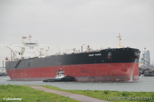
Vessel profile: BERTHA is a Crude Oil Tanker with dimensions 60m x 330m.

This page combines live AIS, route history, probable destination signals, nearby traffic, and port activity for practical vessel monitoring.

The current position of vessel BERTHA is 3.69117 lat / 105.90491 lng. Updated: 2026-03-18 03:22:47 UTC
Nearest reference points:
  • 30 nm SW of Belanak Terminal
  • 39 nm SE of Belida Terminal
  • 26 nm E of Belida Terminal

Currently sailing under the flag of Cook Islands CI flag

BERTHA built in 2004 year

Deadweight:
305442 t

Details:

Live Vessel BERTHA Analytics (details, animations, etc.)


Recent AIS points (UTC):
2026-03-18 03:22:47 UTC · 3.69117, 105.90491 · SOG 0.1 kn · COG -1°

Track of the vessel in the last 60 days


UTC: --
Start: -- Track timeline (UTC) End: --
Encountered: --


Link to the map:


Find another ship

BERTHA (518999103) last ports (portcalls and passsages)

Vancouver | 2025-02-19 07:55:15
Singapore | 2024-02-23 07:54:30
Strait Of Gibraltar | 2023-09-06 08:21:02
Algeciras | 2023-09-05 06:16:05
Singapore | 2023-08-01 01:44:05
Sambu | 2023-07-30 02:56:43
Singapore | 2023-06-08 01:55:43
Strait Of Gibraltar | 2023-01-25 12:11:18
Sambu | 2022-04-06 06:41:39
Mutrah | 2022-02-06 18:43:30
Sriracha | 2022-01-14 08:19:33
Sambu | 2022-01-11 00:47:31
Sambu | 2022-01-11 00:45:25
Singapore | 2022-01-11 00:36:31
Singapore | 2022-01-10 23:55:35
Sambu | 2022-01-10 23:47:18
Das Island | 2021-12-27 04:30:02
Az Zarqa Island | 2021-12-25 12:04:06
Singapore | 2021-12-12 09:01:40
Sambu | 2021-12-09 23:45:29