 ANGEL STAR
Current Status
Where is the vessel?
ANGEL STAR is currently in 30 nm NW of Tanjung Pandan, based on AIS data received about 14h ago.
Latest AIS update:
Current position: 2.46642° S, 107.23777° E (30 nm NW of Tanjung Pandan)
Average speed (last 7 days): Loading…
Average speed (last 30 days): Loading…
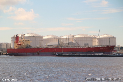
Vessel profile: ANGEL STAR is a Oil Products Tanker with dimensions 30m x 180m.
This page combines live AIS, route history, probable destination signals, nearby traffic, and port activity for practical vessel monitoring.
The current position of vessel ANGEL STAR is -2.46642 lat / 107.23777 lng. Updated: 2026-05-21 04:36:01 UTCNearest reference points:
- 46 nm NW of Tanjung Pandan
- 53 nm NE of Tanjung Pandan
- Near PANGKAL BALAM
Currently sailing under the flag of Marshall Islands ![]()
ANGEL STAR built in 2006 year
Deadweight:
48635 tDetails:
Live Vessel ANGEL STAR Analytics (details, animations, etc.)
Recent AIS points (UTC):
2026-05-20 20:37:11 UTC · -1.14982, 106.39153 · SOG 12.2 kn · COG 148°2026-05-20 20:37:11 UTC · -1.14982, 106.39153 · SOG 12.2 kn · COG 148°
2026-05-20 20:37:11 UTC · -1.14982, 106.39153 · SOG 12.2 kn · COG 148°
2026-05-21 04:36:01 UTC · -2.46642, 107.23777 · SOG 12 kn · COG 167°