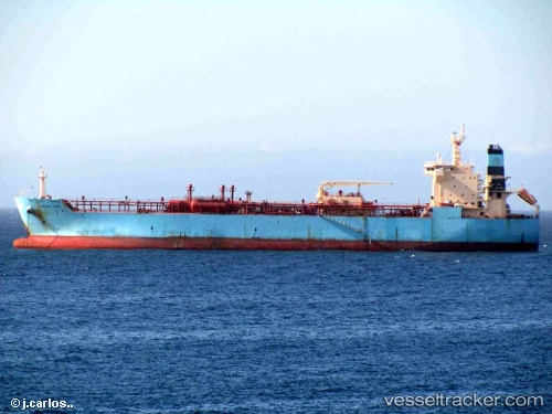
 ALESSANDRO VOLTA
Current Status
Where is the vessel?
ALESSANDRO VOLTA is currently in Near Suape, based on AIS data received about 14h ago.
Latest AIS update:
Current position: 8.39325° S, 34.94934° W (Near Suape)
Average speed (last 7 days): Loading…
Average speed (last 30 days): Loading…
Vessel profile: ALESSANDRO VOLTA is a Lpg Tanker with dimensions m x m.
This page combines live AIS, route history, probable destination signals, nearby traffic, and port activity for practical vessel monitoring.
The current position of vessel ALESSANDRO VOLTA is -8.39325 lat / -34.94934 lng. Updated: 2026-05-19 04:15:54 UTCNearest reference points:
- Near Suape
- Near Boa Viagem
- Near Barra dos Coqueiros
Currently sailing under the flag of Malta ![]()
Details:
Live Vessel ALESSANDRO VOLTA Analytics (details, animations, etc.)
Recent AIS points (UTC):
2026-05-19 01:54:54 UTC · -8.39326, -34.94933 · SOG 0 kn · COG 204°2026-05-19 02:09:55 UTC · -8.39327, -34.94933 · SOG 0 kn · COG 204°
2026-05-19 04:12:54 UTC · -8.39326, -34.94932 · SOG 0 kn · COG 204°
2026-05-19 04:15:54 UTC · -8.39325, -34.94934 · SOG 0 kn · COG 204°