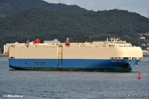
 Liberty Ace
Current Status
Where is the vessel?
Liberty Ace is currently in 334 nm E of FRASER ISLAND, based on AIS data received about 14h ago.
Latest AIS update:
Current position: 24.42752° S, 159.06577° E (334 nm E of FRASER ISLAND)
Average speed (last 7 days): Loading…
Average speed (last 30 days): Loading…
Vessel profile: Liberty Ace is a Vehicles Carrier with dimensions 199m x 200m.
This page combines live AIS, route history, probable destination signals, nearby traffic, and port activity for practical vessel monitoring.
The current position of vessel Liberty Ace is -24.42752 lat / 159.06577 lng. Updated: 2026-05-22 07:37:58 UTCNearest reference points:
- 179 nm E of Beerwah
Currently sailing under the flag of Japan ![]()
Liberty Ace built in 2004 year
Deadweight:
19106 tDetails:
Live Vessel Liberty Ace Analytics (details, animations, etc.)
Recent AIS points (UTC):
2026-05-22 04:04:15 UTC · -24.47426, 158.01921 · SOG 16.2 kn · COG 89°2026-05-22 06:06:21 UTC · -24.42460, 158.62225 · SOG 16.1 kn · COG 87°
2026-05-22 07:31:56 UTC · -24.42481, 159.03700 · SOG 15.9 kn · COG 98°
2026-05-22 07:37:58 UTC · -24.42752, 159.06577 · SOG 15.8 kn · COG 100°