 PORT ALFRED
Current Status
Where is the vessel?
PORT ALFRED is currently in 139 nm W of PONTIANAK, based on AIS data received about 14h ago.
Latest AIS update:
Current position: 0.36666° N, 107.05167° E (139 nm W of PONTIANAK)
Average speed (last 7 days): Loading…
Average speed (last 30 days): Loading…
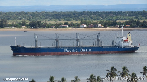
Vessel profile: PORT ALFRED is a Bulk Carrier with dimensions m x m.
This page combines live AIS, route history, probable destination signals, nearby traffic, and port activity for practical vessel monitoring.
The current position of vessel PORT ALFRED is 0.36666 lat / 107.05167 lng. Updated: 2026-07-02 16:44:15 UTCNearest reference points:
- 69 nm NE of Exspan
- 76 nm NE of KIJANG
- 81 nm N of Belitung
Currently sailing under the flag of Indonesia ![]()
Details:
Live Vessel PORT ALFRED Analytics (details, animations, etc.)
Recent AIS points (UTC):
2026-07-02 13:06:27 UTC · 0.51167, 106.53667 · SOG 8 kn · COG -1°2026-07-02 13:42:17 UTC · 0.47500, 106.61666 · SOG 8 kn · COG -1°
2026-07-02 15:26:41 UTC · 0.36333, 106.85333 · SOG 9 kn · COG -1°
2026-07-02 16:44:15 UTC · 0.36666, 107.05167 · SOG 9 kn · COG -1°