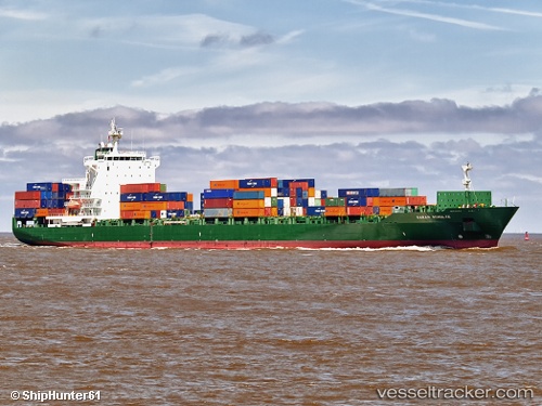
Capt. Thanasis
Current StatusWhere is the vessel?
Capt. Thanasis is currently in 17 nm SE of SUAO, based on AIS data received about 15h ago.
Latest AIS update:
Current position: 24.43952° N, 122.13972° E (17 nm SE of SUAO)
Average speed (last 7 days): Loading…
Average speed (last 30 days): Loading…
Vessel profile: Capt. Thanasis is a Container Ship with dimensions 30m x 222m.
This page combines live AIS, route history, probable destination signals, nearby traffic, and port activity for practical vessel monitoring.
The current position of vessel Capt. Thanasis is 24.43952 lat / 122.13972 lng. Updated: 2026-05-20 15:50:21 UTCNearest reference points:
- Near SUAO
- Near Au-Ao Chaing
- Near I-lan
Details:
Live Vessel Capt. Thanasis Analytics (details, animations, etc.)
Recent AIS points (UTC):
2026-05-20 11:31:07 UTC · 23.48339, 121.87663 · SOG 14.2 kn · COG 10°2026-05-20 13:21:42 UTC · 23.88546, 121.98959 · SOG 13.2 kn · COG 13°
2026-05-20 14:09:18 UTC · 24.05981, 122.04039 · SOG 14 kn · COG 12°
2026-05-20 15:50:21 UTC · 24.43952, 122.13972 · SOG 13.6 kn · COG 12°