 VALIANTA
Current Status
Where is the vessel?
VALIANTA is currently in Near Bejaia, based on AIS data received about 16h ago.
Latest AIS update:
Current position: 36.71258° N, 5.18917° E (Near Bejaia)
Average speed (last 7 days): Loading…
Average speed (last 30 days): Loading…
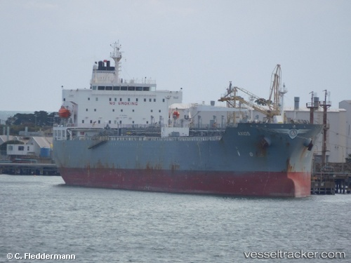
Vessel profile: VALIANTA is a Chemical/Oil Products Tanker with dimensions 183m x 32m.
This page combines live AIS, route history, probable destination signals, nearby traffic, and port activity for practical vessel monitoring.
The current position of vessel VALIANTA is 36.71258 lat / 5.18917 lng. Updated: 2026-05-20 13:50:01 UTCNearest reference points:
- Near Bejaia
- Near Carmona
- Near Zamoranos
Currently sailing under the flag of Marshall Is ![]()
VALIANTA built in 2006 year
Deadweight:
46792 tDetails:
Live Vessel VALIANTA Analytics (details, animations, etc.)
Recent AIS points (UTC):
2026-05-20 10:26:05 UTC · 36.71311, 5.18886 · SOG 0 kn · COG 84°2026-05-20 11:47:00 UTC · 36.71390, 5.18902 · SOG 0 kn · COG 118°
2026-05-20 13:25:59 UTC · 36.71303, 5.18891 · SOG 0.1 kn · COG 84°
2026-05-20 13:50:01 UTC · 36.71258, 5.18917 · SOG 0 kn · COG 61°