 vesseltracker.com
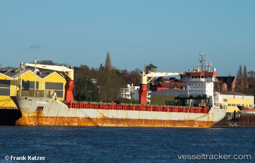
 Marmolokai
Current Status
Where is the vessel?
Marmolokai is currently in 14 nm SE of Grankullavik, based on AIS data received about 1h ago.
Latest AIS update:
Current position: 57.22318° N, 17.48745° E (14 nm SE of Grankullavik)
Average speed (last 7 days): Loading…
Average speed (last 30 days): Loading…
Vessel profile: Marmolokai is a Multi Purpose Carrier with dimensions 145m x 18m.
This page combines live AIS, route history, probable destination signals, nearby traffic, and port activity for practical vessel monitoring.
The current position of vessel Marmolokai is 57.22318 lat / 17.48745 lng. Updated: 2026-05-15 13:29:42 UTCNearest reference points:
- Near Stora Vika
- Near Krokek
- Near SODERTALJE
Currently sailing under the flag of Antigua Barbuda ![]()
Marmolokai built in 2004 year
Deadweight:
10649 tDetails:
Live Vessel Marmolokai Analytics (details, animations, etc.)
Recent AIS points (UTC):
2026-05-15 10:16:17 UTC · 57.87109, 18.07848 · SOG 13.4 kn · COG 205°2026-05-15 11:43:48 UTC · 57.58312, 17.77627 · SOG 13.5 kn · COG 208°
2026-05-15 13:09:07 UTC · 57.29481, 17.53940 · SOG 13.5 kn · COG 199°
2026-05-15 13:29:42 UTC · 57.22318, 17.48745 · SOG 13.4 kn · COG 201°