 vesseltracker.com
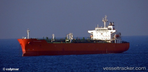
 ELORA 1
Current Status
Where is the vessel?
ELORA 1 is currently in Near Choa Chu Kang, based on AIS data received less than 1h ago.
Latest AIS update:
Current position: 1.28136° N, 103.90446° E (Near Choa Chu Kang)
Average speed (last 7 days): Loading…
Average speed (last 30 days): Loading…
Vessel profile: ELORA 1 is a Oil/Chemical Tanker with dimensions m x m.
This page combines live AIS, route history, probable destination signals, nearby traffic, and port activity for practical vessel monitoring.
The current position of vessel ELORA 1 is 1.28136 lat / 103.90446 lng. Updated: 2026-05-14 22:11:32 UTCNearest reference points:
- Near Tampines
- Near Choa Chu Kang
- Near Changi
Currently sailing under the flag of Panama ![]()
Details:
Live Vessel ELORA 1 Analytics (details, animations, etc.)
Recent AIS points (UTC):
2026-05-14 18:15:34 UTC · 1.28317, 103.90684 · SOG 0 kn · COG 231°2026-05-14 19:12:32 UTC · 1.28307, 103.90682 · SOG 0 kn · COG 239°
2026-05-14 20:15:14 UTC · 1.28254, 103.90685 · SOG 0 kn · COG 263°
2026-05-14 22:11:32 UTC · 1.28136, 103.90446 · SOG 0 kn · COG 52°