 SANTA VIOLA
Current Status
Where is the vessel?
SANTA VIOLA is currently in 24 nm N of Longyan Pt, based on AIS data received about 14h ago.
Latest AIS update:
Current position: 37.81668° N, 122.78723° E (24 nm N of Longyan Pt)
Average speed (last 7 days): Loading…
Average speed (last 30 days): Loading…
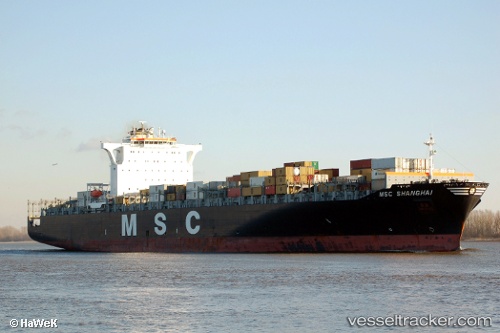
Vessel profile: SANTA VIOLA is a Container Ship with dimensions m x m.
This page combines live AIS, route history, probable destination signals, nearby traffic, and port activity for practical vessel monitoring.
The current position of vessel SANTA VIOLA is 37.81668 lat / 122.78723 lng. Updated: 2026-05-25 01:34:32 UTCNearest reference points:
- 15 nm N of Longyan Pt
- 16 nm NE of Longyan Pt
- 13 nm N of Longyan Pt
Currently sailing under the flag of Malta ![]()
Details:
Live Vessel SANTA VIOLA Analytics (details, animations, etc.)
Recent AIS points (UTC):
2026-05-24 23:04:55 UTC · 38.06607, 122.05336 · SOG 15 kn · COG 112°2026-05-24 23:54:15 UTC · 37.99273, 122.29894 · SOG 15.1 kn · COG 115°
2026-05-25 01:27:56 UTC · 37.82753, 122.75478 · SOG 15 kn · COG 113°
2026-05-25 01:34:32 UTC · 37.81668, 122.78723 · SOG 15.2 kn · COG 112°