 PANDA
PANDA
Current Status
Where is the vessel?
PANDA is currently in 14 nm SE of Rizhao, based on AIS data received about 14h ago.
Latest AIS update:
Current position: 35.25715° N, 119.79518° E (14 nm SE of Rizhao)
Average speed (last 7 days): Loading…
Average speed (last 30 days): Loading…
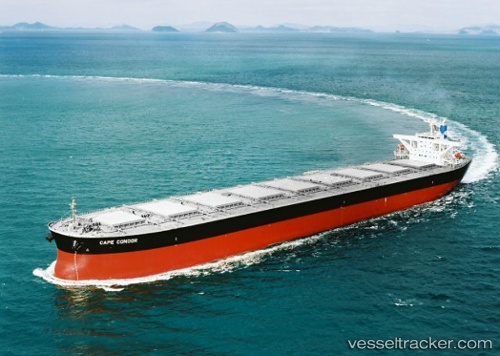
Vessel profile: PANDA is a Bulk Carrier with dimensions 45m x 288m.
This page combines live AIS, route history, probable destination signals, nearby traffic, and port activity for practical vessel monitoring.
The current position of vessel PANDA is 35.25715 lat / 119.79518 lng. Updated: 2026-05-19 21:23:06 UTCNearest reference points:
- 11 nm SE of Rizhao
- 14 nm S of DONGJIAKOU
- Near Rizhao
Currently sailing under the flag of Marshall Islands ![]()
PANDA built in 2004 year
Deadweight:
180181 tDetails:
Live Vessel PANDA Analytics (details, animations, etc.)
Recent AIS points (UTC):
2026-05-19 18:08:07 UTC · 35.26164, 119.80026 · SOG 0 kn · COG 207°2026-05-19 19:14:32 UTC · 35.26177, 119.79813 · SOG 0.2 kn · COG -1°
2026-05-19 20:14:38 UTC · 35.25948, 119.79511 · SOG 0.1 kn · COG -1°
2026-05-19 21:23:06 UTC · 35.25715, 119.79518 · SOG 0.1 kn · COG 60°