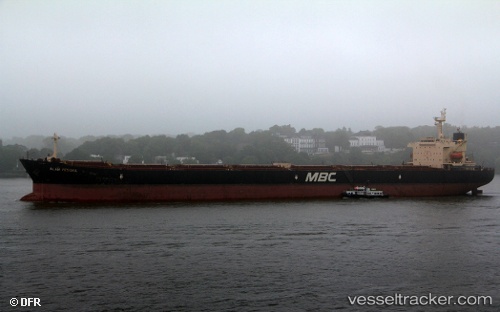
Captain Mike
Current StatusWhere is the vessel?
Captain Mike is currently in Near EL DEKHEILA, based on AIS data received about 14h ago.
Latest AIS update:
Current position: 31.13713° N, 29.79571° E (Near EL DEKHEILA)
Average speed (last 7 days): Loading…
Average speed (last 30 days): Loading…
Vessel profile: Captain Mike is a Bulk Carrier with dimensions 37m x 229m.
This page combines live AIS, route history, probable destination signals, nearby traffic, and port activity for practical vessel monitoring.
The current position of vessel Captain Mike is 31.13713 lat / 29.79571 lng. Updated: 2026-05-21 05:20:51 UTCNearest reference points:
- Near Alexandria
- Near EL DEKHEILA
- 13 nm W of EL DEKHEILA
Details:
Live Vessel Captain Mike Analytics (details, animations, etc.)
Recent AIS points (UTC):
2026-05-21 02:02:48 UTC · 31.13711, 29.79570 · SOG 0 kn · COG 213°2026-05-21 03:50:52 UTC · 31.13709, 29.79569 · SOG 0 kn · COG 213°
2026-05-21 04:32:50 UTC · 31.13710, 29.79571 · SOG 0 kn · COG 213°
2026-05-21 05:20:51 UTC · 31.13713, 29.79571 · SOG 0 kn · COG 213°