 HAWKS VICTORY
Current Status
Where is the vessel?
HAWKS VICTORY is currently in 19 nm E of Offshore Fujairah, based on AIS data received about 14h ago.
Latest AIS update:
Current position: 25.15156° N, 56.99363° E (19 nm E of Offshore Fujairah)
Average speed (last 7 days): Loading…
Average speed (last 30 days): Loading…
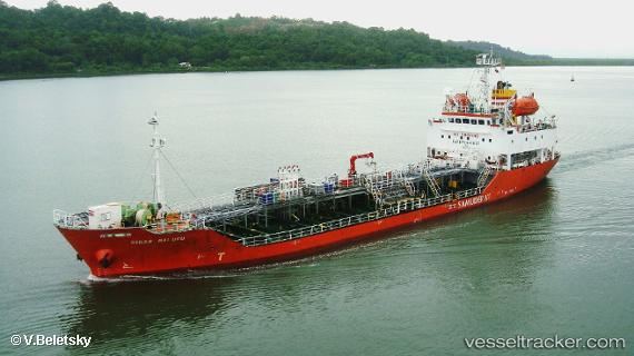
Vessel profile: HAWKS VICTORY is a Oil/Chemical Tanker with dimensions m x m.
This page combines live AIS, route history, probable destination signals, nearby traffic, and port activity for practical vessel monitoring.
The current position of vessel HAWKS VICTORY is 25.15156 lat / 56.99363 lng. Updated: 2026-06-27 14:27:59 UTCNearest reference points:
- Near Offshore Fujairah
- 42 nm SE of Offshore Fujairah
- 30 nm NE of Offshore Fujairah
Currently sailing under the flag of Panama ![]()
Details:
Live Vessel HAWKS VICTORY Analytics (details, animations, etc.)
Recent AIS points (UTC):
2026-06-27 10:58:30 UTC · 25.07131, 57.02843 · SOG 1.7 kn · COG 353°2026-06-27 11:48:28 UTC · 25.09311, 57.01691 · SOG 1.7 kn · COG 5°
2026-06-27 13:57:19 UTC · 25.14183, 56.99706 · SOG 1.2 kn · COG 5°
2026-06-27 14:27:59 UTC · 25.15156, 56.99363 · SOG 1.2 kn · COG 23°