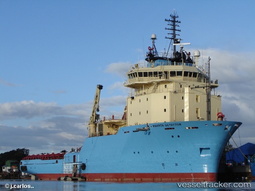
 DETECTOR
Current Status
Where is the vessel?
DETECTOR is currently in Near Harboør, based on AIS data received about 14h ago.
Latest AIS update:
Current position: 56.66937° N, 7.99556° E (Near Harboør)
Average speed (last 7 days): Loading…
Average speed (last 30 days): Loading…
Vessel profile: DETECTOR is a Anchor Handling Vessel with dimensions m x m.
This page combines live AIS, route history, probable destination signals, nearby traffic, and port activity for practical vessel monitoring.
The current position of vessel DETECTOR is 56.66937 lat / 7.99556 lng. Updated: 2026-06-23 11:27:00 UTCNearest reference points:
- Near Thyborøn
- Near Kleppen
- Near HANSTHOLM
Currently sailing under the flag of Denmark ![]()
Details:
Live Vessel DETECTOR Analytics (details, animations, etc.)
Recent AIS points (UTC):
2026-06-23 08:04:59 UTC · 56.50800, 7.21858 · SOG 8 kn · COG 65°2026-06-23 09:34:06 UTC · 56.58385, 7.56629 · SOG 8.2 kn · COG 67°
2026-06-23 11:24:03 UTC · 56.66601, 7.98119 · SOG 10.4 kn · COG 67°
2026-06-23 11:27:00 UTC · 56.66937, 7.99556 · SOG 10.2 kn · COG 68°