 NEW STAR
Current Status
Where is the vessel?
NEW STAR is currently in 135 nm W of Abakaliki, based on AIS data received about 14h ago.
Latest AIS update:
Current position: 5.81167° N, 83.79500° E (135 nm W of Abakaliki)
Average speed (last 7 days): Loading…
Average speed (last 30 days): Loading…
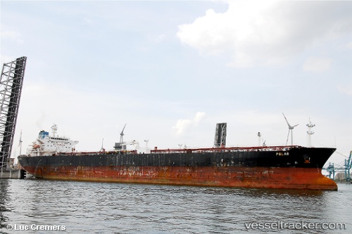
Vessel profile: NEW STAR is a Crude Oil Tanker with dimensions m x m.
This page combines live AIS, route history, probable destination signals, nearby traffic, and port activity for practical vessel monitoring.
The current position of vessel NEW STAR is 5.81167 lat / 83.79500 lng. Updated: 2026-05-20 13:15:25 UTCNearest reference points:
- 127 nm W of Abakaliki
- 79 nm E of Konwelana
- 75 nm E of Konwelana
Currently sailing under the flag of Mozambique ![]()
Details:
Live Vessel NEW STAR Analytics (details, animations, etc.)
Recent AIS points (UTC):
2026-05-20 10:05:20 UTC · 5.81333, 84.21667 · SOG 8 kn · COG -1°2026-05-20 10:38:29 UTC · 5.81167, 84.14167 · SOG 8 kn · COG -1°
2026-05-20 11:20:43 UTC · 5.81833, 84.04667 · SOG 8 kn · COG -1°
2026-05-20 13:15:25 UTC · 5.81167, 83.79500 · SOG 7 kn · COG -1°