 VIREL
VIREL
Current Status
Where is the vessel?
VIREL is currently in 37 nm S of Sarinena, based on AIS data received about 14h ago.
Latest AIS update:
Current position: 41.17971° N, 9.80935° W (37 nm S of Sarinena)
Average speed (last 7 days): Loading…
Average speed (last 30 days): Loading…
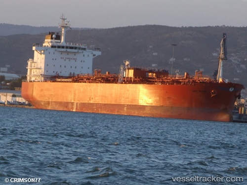
Vessel profile: VIREL is a Oil/Chemical Tanker with dimensions m x m.
This page combines live AIS, route history, probable destination signals, nearby traffic, and port activity for practical vessel monitoring.
The current position of vessel VIREL is 41.17971 lat / -9.80935 lng. Updated: 2026-05-20 00:10:43 UTCNearest reference points:
- 52 nm W of Canas de Santa Maria
- 11 nm S of Sarinena
- Near POVOA DE VARZIM
Currently sailing under the flag of Cameroon ![]()
Details:
Live Vessel VIREL Analytics (details, animations, etc.)
Recent AIS points (UTC):
2026-05-19 19:49:53 UTC · 40.32361, -9.86367 · SOG 12 kn · COG 2°2026-05-19 22:13:14 UTC · 40.80087, -9.86239 · SOG 12.1 kn · COG 4°
2026-05-19 23:07:04 UTC · 40.97828, -9.86254 · SOG 11.6 kn · COG 11°
2026-05-20 00:10:43 UTC · 41.17971, -9.80935 · SOG 11.6 kn · COG 359°