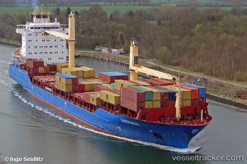
 Langeness
Current Status
Where is the vessel?
Langeness is currently in 108 nm SW of Raichur, based on AIS data received about 15h ago.
Latest AIS update:
Current position: 14.78728° N, 78.51889° W (108 nm SW of Raichur)
Average speed (last 7 days): Loading…
Average speed (last 30 days): Loading…
Vessel profile: Langeness is a Container Ship with dimensions 161m x 25m.
This page combines live AIS, route history, probable destination signals, nearby traffic, and port activity for practical vessel monitoring.
The current position of vessel Langeness is 14.78728 lat / -78.51889 lng. Updated: 2026-05-19 17:42:44 UTCCurrently sailing under the flag of Antigua Barbuda ![]()
Langeness built in 2006 year
Deadweight:
17002 tDetails:
Live Vessel Langeness Analytics (details, animations, etc.)
Recent AIS points (UTC):
2026-05-19 13:54:07 UTC · 14.04500, -78.69667 · SOG 11 kn · COG -1°2026-05-19 15:57:27 UTC · 14.44167, -78.59833 · SOG 12 kn · COG -1°
2026-05-19 15:57:27 UTC · 14.44167, -78.59833 · SOG 12 kn · COG -1°
2026-05-19 17:42:44 UTC · 14.78728, -78.51889 · SOG 12 kn · COG 16°