 Ym Heights
Current Status
Where is the vessel?
Ym Heights is currently in Near SUNGAI UDANG, based on AIS data received about 14h ago.
Latest AIS update:
Current position: 2.10884° N, 102.08315° E (Near SUNGAI UDANG)
Average speed (last 7 days): Loading…
Average speed (last 30 days): Loading…
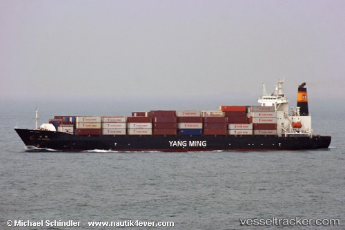
Vessel profile: Ym Heights is a Container Ship with dimensions 169m x 27m.
This page combines live AIS, route history, probable destination signals, nearby traffic, and port activity for practical vessel monitoring.
The current position of vessel Ym Heights is 2.10884 lat / 102.08315 lng. Updated: 2026-06-02 18:03:04 UTCNearest reference points:
- Near Malacca
- Near SUNGAI UDANG
- Near MELAKA
Currently sailing under the flag of Taiwan ![]()
Ym Heights built in 2005 year
Deadweight:
19104 tDetails:
Live Vessel Ym Heights Analytics (details, animations, etc.)
Recent AIS points (UTC):
2026-06-02 13:38:25 UTC · 1.66801, 102.92622 · SOG 14 kn · COG 295°2026-06-02 15:48:58 UTC · 1.86336, 102.45240 · SOG 14.3 kn · COG 300°
2026-06-02 16:28:52 UTC · 1.93124, 102.33553 · SOG 11.8 kn · COG 296°
2026-06-02 18:03:04 UTC · 2.10884, 102.08315 · SOG 12.1 kn · COG 312°