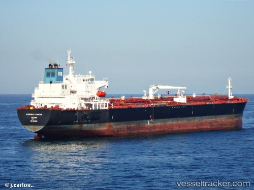
Seaways Visayas
Current StatusWhere is the vessel?
Seaways Visayas is currently in Near KULEVI, based on AIS data received about 15h ago.
Latest AIS update:
Current position: 42.27458° N, 41.63719° E (Near KULEVI)
Average speed (last 7 days): Loading…
Average speed (last 30 days): Loading…
Vessel profile: Seaways Visayas is a Crude Oil Tanker with dimensions 36m x 228m.
This page combines live AIS, route history, probable destination signals, nearby traffic, and port activity for practical vessel monitoring.
The current position of vessel Seaways Visayas is 42.27458 lat / 41.63719 lng. Updated: 2026-06-16 18:02:05 UTCNearest reference points:
- Near KULEVI
- Near Poti
- Near Sup'sa
Details:
Live Vessel Seaways Visayas Analytics (details, animations, etc.)
Recent AIS points (UTC):
2026-06-16 13:44:05 UTC · 42.27459, 41.63723 · SOG 0 kn · COG 287°2026-06-16 13:44:05 UTC · 42.27459, 41.63723 · SOG 0 kn · COG 287°
2026-06-16 13:44:05 UTC · 42.27459, 41.63723 · SOG 0 kn · COG 287°
2026-06-16 18:02:05 UTC · 42.27458, 41.63719 · SOG 0 kn · COG 287°