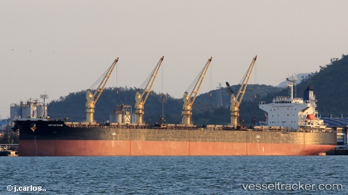
Antakya M
Current StatusWhere is the vessel?
Antakya M is currently in Near Icdas Jetty, based on AIS data received about 14h ago.
Latest AIS update:
Current position: 40.45070° N, 27.13645° E (Near Icdas Jetty)
Average speed (last 7 days): Loading…
Average speed (last 30 days): Loading…
Vessel profile: Antakya M is a Bulk Carrier with dimensions 32m x 190m.
This page combines live AIS, route history, probable destination signals, nearby traffic, and port activity for practical vessel monitoring.
The current position of vessel Antakya M is 40.45070 lat / 27.13645 lng. Updated: 2026-06-29 07:57:31 UTCNearest reference points:
- Near Sarköy
- Near Marmara Adasi
- Near Saraylar
Details:
Live Vessel Antakya M Analytics (details, animations, etc.)
Recent AIS points (UTC):
2026-06-29 05:12:26 UTC · 40.45075, 27.13649 · SOG 0 kn · COG 201°2026-06-29 05:12:26 UTC · 40.45075, 27.13649 · SOG 0 kn · COG 201°
2026-06-29 07:27:30 UTC · 40.45074, 27.13651 · SOG 0 kn · COG 201°
2026-06-29 07:57:31 UTC · 40.45070, 27.13645 · SOG 0 kn · COG 201°