 vesseltracker.com
 Vs Leia
Current Status
Where is the vessel?
Vs Leia is currently in Near Sekupang, based on AIS data received less than 1h ago.
Latest AIS update:
Current position: 1.09593° N, 103.89003° E (Near Sekupang)
Average speed (last 7 days): Loading…
Average speed (last 30 days): Loading…
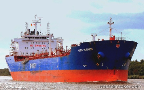
Vessel profile: Vs Leia is a Oil Products Tanker with dimensions 183m x 27m.
This page combines live AIS, route history, probable destination signals, nearby traffic, and port activity for practical vessel monitoring.
The current position of vessel Vs Leia is 1.09593 lat / 103.89003 lng. Updated: 2026-05-16 12:24:22 UTCNearest reference points:
- Near Sekupang
- Near Sambu
- Near Batam Island
Currently sailing under the flag of United Kingdom ![]()
Vs Leia built in 2006 year
Deadweight:
38461 tDetails:
Live Vessel Vs Leia Analytics (details, animations, etc.)
Recent AIS points (UTC):
2026-05-16 07:51:22 UTC · 1.09595, 103.89000 · SOG 0 kn · COG 2°2026-05-16 10:15:22 UTC · 1.09592, 103.89002 · SOG 0 kn · COG 2°
2026-05-16 10:27:22 UTC · 1.09591, 103.89002 · SOG 0 kn · COG 2°
2026-05-16 12:24:22 UTC · 1.09593, 103.89003 · SOG 0 kn · COG 2°