Amina
Current StatusWhere is the vessel?
Amina is currently in Near Chah Bahar, based on AIS data received about 14h ago.
Latest AIS update:
Current position: 25.20296° N, 60.56317° E (Near Chah Bahar)
Average speed (last 7 days): Loading…
Average speed (last 30 days): Loading…
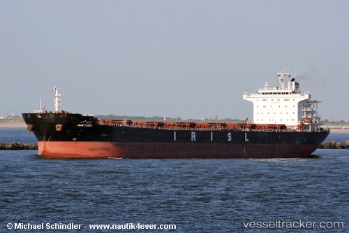
Vessel profile: Amina is a Bulk Carrier with dimensions 33m x 225m.
This page combines live AIS, route history, probable destination signals, nearby traffic, and port activity for practical vessel monitoring.
The current position of vessel Amina is 25.20296 lat / 60.56317 lng. Updated: 2026-05-20 13:23:31 UTCNearest reference points:
- 59 nm S of Chah Bahar
- 97 nm S of Chabahar
- 101 nm SE of Chabahar
Details:
Live Vessel Amina Analytics (details, animations, etc.)
Recent AIS points (UTC):
2026-05-20 11:02:39 UTC · 25.20320, 60.56271 · SOG 0.1 kn · COG 205°2026-05-20 11:36:42 UTC · 25.20322, 60.56286 · SOG 0.2 kn · COG 209°
2026-05-20 13:23:31 UTC · 25.20296, 60.56317 · SOG 0.2 kn · COG 220°
2026-05-20 13:23:31 UTC · 25.20296, 60.56317 · SOG 0.2 kn · COG 220°