 vesseltracker.com
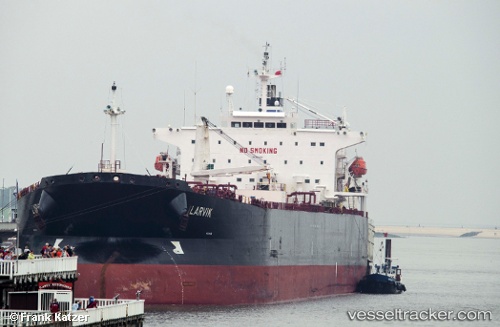
 Larvik
Current Status
Where is the vessel?
Larvik is currently in 17 nm SE of Port Bolivar, based on AIS data received about 1h ago.
Latest AIS update:
Current position: 29.23490° N, 94.45667° W (17 nm SE of Port Bolivar)
Average speed (last 7 days): Loading…
Average speed (last 30 days): Loading…
Vessel profile: Larvik is a Crude Oil Tanker with dimensions 214m x 32m.
This page combines live AIS, route history, probable destination signals, nearby traffic, and port activity for practical vessel monitoring.
The current position of vessel Larvik is 29.23490 lat / -94.45667 lng. Updated: 2026-05-17 19:33:35 UTCNearest reference points:
- 12 nm SE of Port Bolivar
- Near Port Bolivar
- 23 nm SW of Sabine Pass
Currently sailing under the flag of Bahamas ![]()
Larvik built in 2006 year
Deadweight:
61213 tDetails:
Live Vessel Larvik Analytics (details, animations, etc.)
Recent AIS points (UTC):
2026-05-17 16:39:43 UTC · 29.23622, -94.45670 · SOG 0 kn · COG 114°2026-05-17 17:48:36 UTC · 29.23565, -94.45671 · SOG 0.1 kn · COG 110°
2026-05-17 19:12:43 UTC · 29.23498, -94.45680 · SOG 0 kn · COG 91°
2026-05-17 19:33:35 UTC · 29.23490, -94.45667 · SOG 0 kn · COG 95°